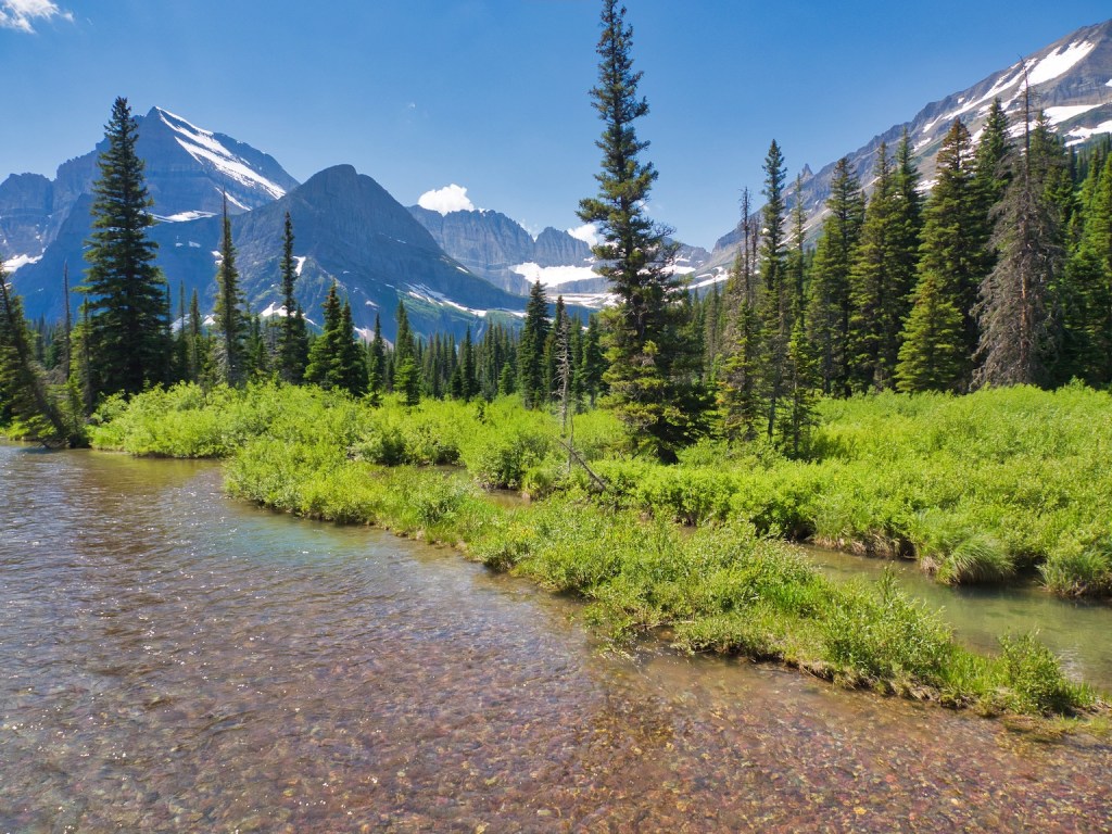
Tag: Many Glacier Region
-
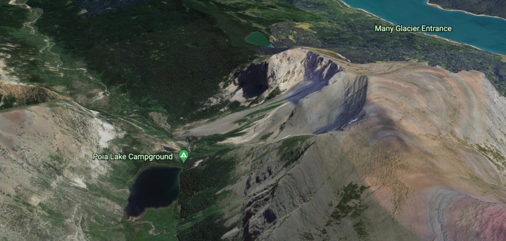
Poia Lake
Poia Lake, named after a hero in Blackfeet mythology, is a beautiful 30-acre body of water lying at an elevation of 5,800 feet near the transition zone of subalpine to alpine in the Kennedy Creek drainage. Choose the challenging out and back hike, a mellow overnighter, or travel on the…
-
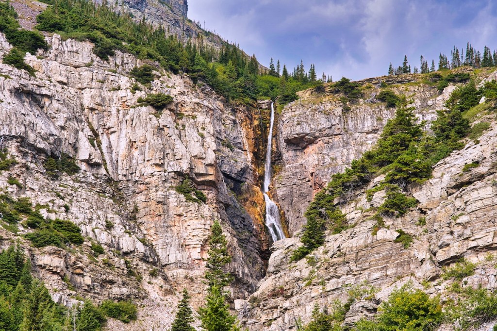
Apikuni Falls
The liquid snow of Apikuni Creek presents a spectacular show when the Earth drops out from beneath it. The water plummets 160 feet over 1.5 billion-year-old Altyn limestone, the oldest rock on the park’s east side.1,2 Trailhead Apikuni Falls Trail leaves the parking area to the northwest and the Red…
-
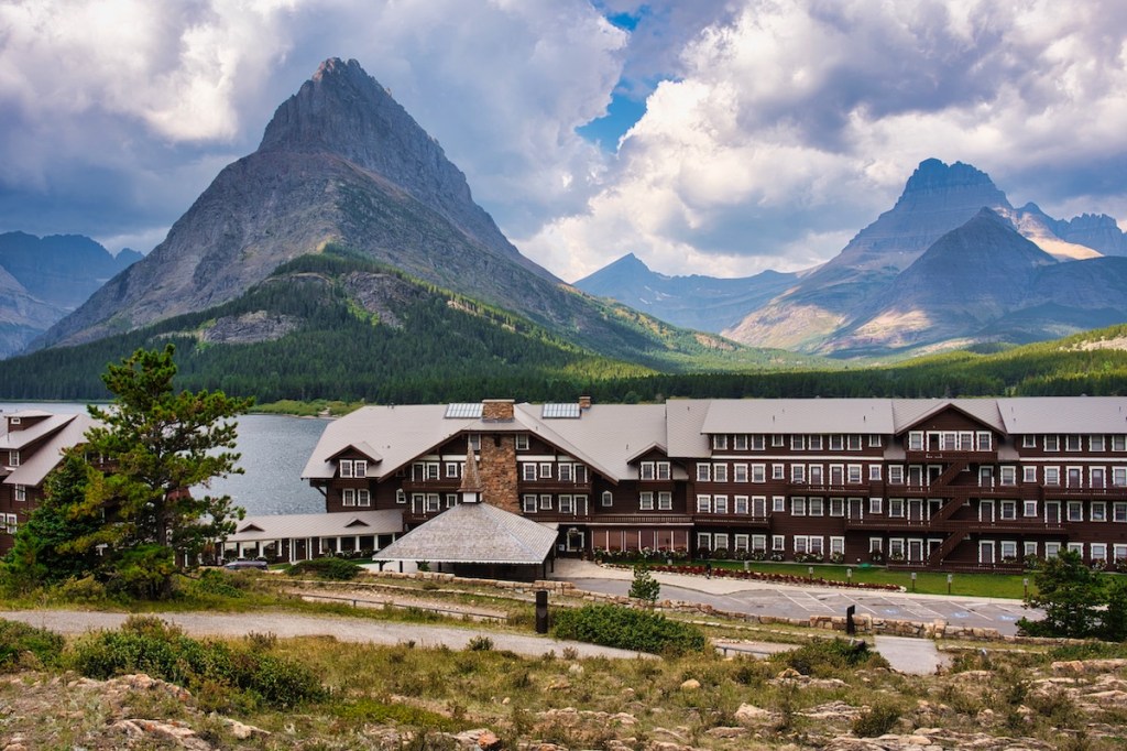
Swiftcurrent Lake Nature Trail
If you’re looking for a family-friendly hike that includes history, outstanding scenery, and wildlife, the loop around Swiftcurrent Lake in Many Glacier is hard to beat. This is one that can be enjoyed May through October. Trailhead Location The most popular places to access the trail are near the Many…
-

3 Lakes, Waterfalls & Swiftcurrent Pass
Hiking and history notes for your walk up the spectacular Swiftcurrent Valley.
-
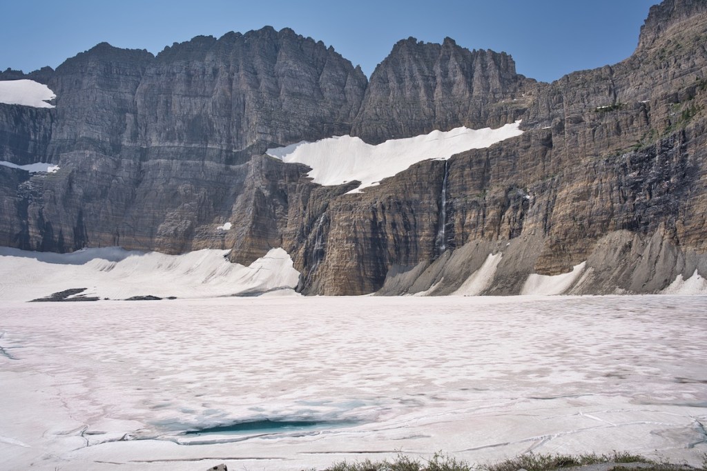
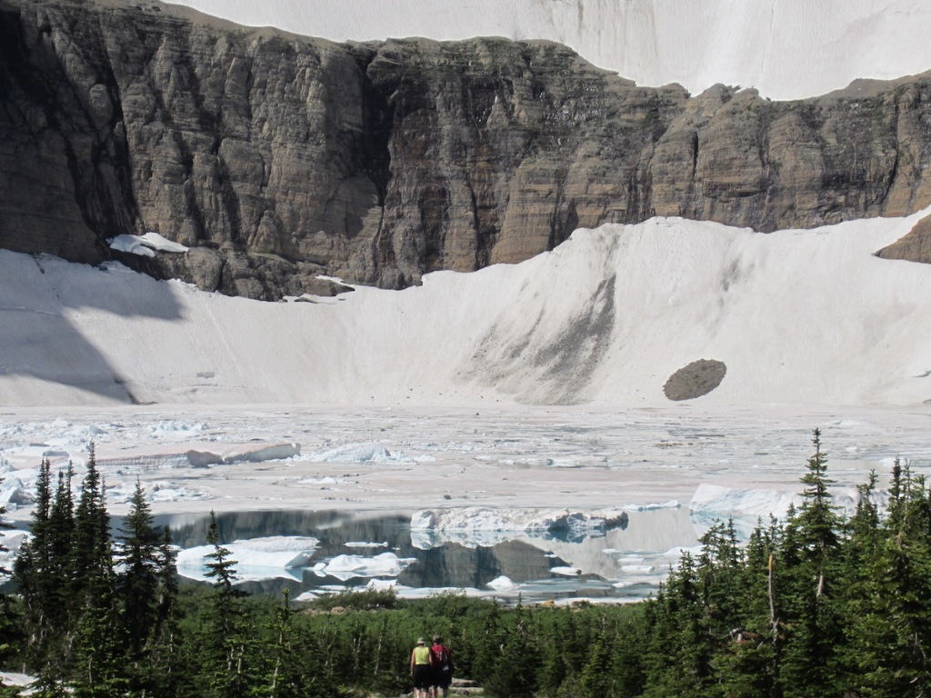
Grinnell Glacier & Upper Grinnell Lake
On November 2, 1887, after three days of bushwhacking, George Bird Grinnell, Jack Monroe, and James Willard Schultz scaled the headwall of a magnificent glacial valley. The team was probably all smiles when they climbed up onto the glacier Grinnell had spotted through his spyglass two years earlier.2 Grinnell estimated…
-
Iceberg Lake
The spectacular Iceberg Lake day hike in Glacier National Park should be on your must do list while in the Many Glacier region.
-

Piegan Pass Through-Hike
Trailhead Many Glacier and the Going-to-the-Sun Road are the two most common starting points for accessing Piegan Pass. This blog will describe a trip beginning at the trailhead on Siyeh Bend, 2.2 miles east of Logan Pass, and ending at the Many Glacier Hotel. The total distance is about 13…
-
Grinnell Lake
No matter how often I hike in the Many Glacier region, I’m always filled with awe. The grandeur of the glacially carved mountains is both exhilarating and humbling. Once on the trail, the sights, sounds, and smells that command my attention result in restorative therapy second to none. Grinnell Lake…
-
Ptarmigan Tunnel, Red Gap Pass Loop
This is an outstanding backpacking trip that begins and ends in Many Glacier. It includes a side trip to the head of Elizabeth Lake and a short hike to Helen Lake. The total trip from trailhead to trailhead, including the side trip, is 35.2 miles. If you decide to start…

