
If you seek solitude and don’t mind walking through a forest without grand vistas, this may be your hike. Consider doing this trip in late summer or fall to avoid the worst of the seasonal mosquito population.
Trailhead
In the northwest corner of the park near Bowman Lake, the historic West Lakes Trail continues northward, providing access to both Akokala Lake and the Inside North Fork Road. To reach Bowman Lake from the Polebridge Entrance, turn left onto the Inside North Fork Road, then take the first right onto Bowman Lake Road. The narrow, rough, six-mile gravel road with many blind curves climbs to the Bowman Lake day-use parking and campground area. Look for the multitude of purple lupine blossoms in the old burn area during June or early July.
From the day-use parking area, walk into the campground loop toward campsite 22. The trailhead sign for Akokala Lake is next to this site.
Hike Summary
| Total Distance: 11.6 miles |
| Total Elevation Gain: 1,439 feet | Loss: 731 feet |
| Difficulty: 14.5, strenuous (Calculated using Petzoldt’s Energy Rated Mile equation.) |
| Total Walking Time: 5 hours 21 minutes (Calculated using an average moving speed of 2.5 mph and Naismith’s correction for elevation gain.) |
The Hike
The most demanding segment of this adventure occurs within the first 1.6 miles, where the trail climbs 722 feet through a dense, mixed forest of Douglas fir, larch, and lodgepole pine. As you walk along, be sure to make noise, especially in brushy areas and blind curves. Keep your bear spray where you can access it quickly. Both black and grizzly bears inhabit the area, and I noticed tracks from both on the trail.
At 2.5 miles and 4,900 feet, the trail passes the crest of Numa Ridge and begins its descent to Akokala Creek. The junction for the trail to the lake is another 0.1 mile ahead and is well-signed.
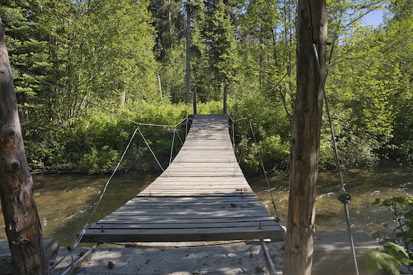
The footpath on this last section traverses a south-southeast aspect of the ridge extending southward from Reuter Peak. This exposure results in drier terrain than that through which you just traveled, resulting in a less brushy and well-maintained walking surface.
Along this stretch, I encountered a spruce grouse hen making a pitiful, almost childlike whimpering sound. Assuming she had a nest nearby, I continued walking to clear her territory. However, as soon as I turned my back, she shifted from a helpless creature to one possessed and aggressively pursued me until I crossed an unseen boundary, at which point she abruptly relaxed and retreated into the underbrush.
As you near the destination, a short spur trail on the right leads to the Akokala Lake backcountry campground. A sign shows three individual sites, a food preparation area, and a pit toilet. The most desirable campsite sits on a small rise above the lake, offering filtered views of the water and Akokala Creek.
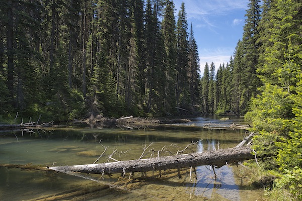
Return to the main trail to reach the lake. Avoid a faint path that branches to the left, as it dissolves into thick brush. The main trail ends at the edge of the 23-acre lake and a small beach. When I visited in June, clouds of mosquitoes greeted me at the water’s edge.
Akokala Lake is one of the last bull trout supporting lakes on the west side of the park.1 Biologists have determined that Akokala Lake serves as a critical native nursery for bull trout and is thus the reason for the no-fishing signs. In 2015, workers installed a fish passage barrier on lower Akokala Creek to keep lake trout from migrating to these waters.2
Notes
- Germann, Denise. “Fish Passage Barrier to be Constructed.” National Park Service, Glacier National Park. Last modified September 30, 2014. https://www.nps.gov/glac/learn/news/fish-passage-barrier-to-be-constructed.htm.
- Meeuwig, Michael H., Christopher S. Guy, and Wade A. Fredenberg. “Research Summary for Action Plan to Conserve Bull Trout in Glacier National Park, Montana,.” (December 2007). https://myfwp.mt.gov.


Leave a comment