Trailhead
On the Going-to-the-Sun Road, drive 1.5 miles north of the Lake McDonald Lodge and turn left onto North McDonald Road. Continue to the end of this road, a little over 3 miles away. There you will find a small parking area and the trailhead sign.
Hike Summary
| Total Distance: 4.8 miles |
| Total Elevation Gain: 113 feet | Loss: 198 feet |
| Difficulty: 5.1, moderate (Calculated using Petzoldt’s Energy Rated Mile equation.) |
| Total Walking Time: 2 hours (Calculated using an average moving speed of 2.5 mph and Naismith’s correction for elevation gain.) |
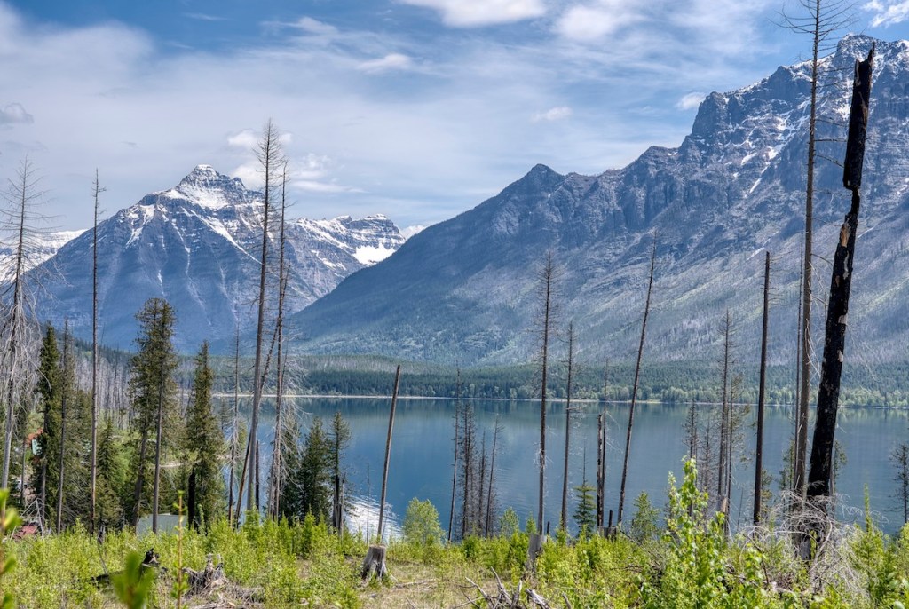
The Hike
As you head down the trail, you’ll be passing through a piece of living history. Two major wildfires shaped this area—the Roberts Fire in 2003 and the Howe Ridge Fire in 2018. It’s an incredible front-row seat to see how a forest heals. You’ll see plenty of young western hemlocks, western redcedars, larches, and spruces making a comeback.
Because these new trees offer little shade, consider planning this hike for early or late season, or for the cool of the morning.
As you keep walking, you’ll notice how erratic wildfires can be. You’ll pass through areas that experienced less intense heat and have lush, vibrant regrowth, and others where the fire was more intense and have less vegetation. About 1.8 miles into the hike, you’ll walk through a remnant of the old-growth cedar forest that somehow survived the flames.
Campground
Around the 2.3-mile mark, watch for a small brown sign marking the campground spur trail. The lettering is on the side away from you.
The path to the left leads to the food preparation area, an outhouse, and two campsites. The real prize is the inviting pebble beach a short distance away. From there, take in the classic Glacier National Park panorama provided by Mount Brown, Mount Edwards, and Gunsight Mountain. A little farther north, look for Mount Cannon towering over the entrance to Avalanche Basin.

Leave a comment