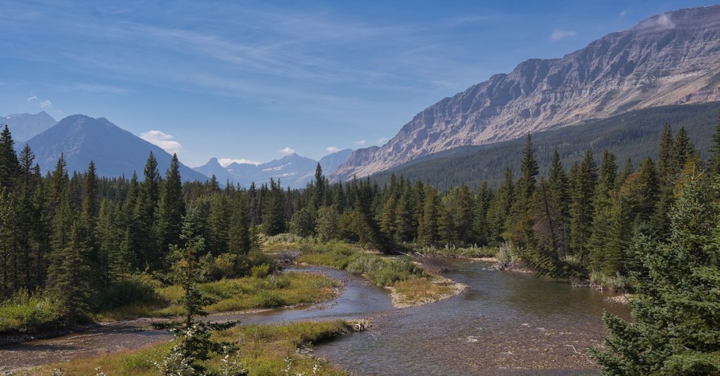
This adventure in the Belly River region begins in the northeastern corner of Glacier National Park, about three-quarters of a mile south of the international border with Canada. If exploring a remote area in the Glacier National Park wilderness appeals to you, read on.
Planning
Because of the location, consider distances to the nearest help should an emergency arise. The nearest are the Belly River Ranger Station and the U.S. Customs Station. Depending where you are in the hike, one will be better than the other. Know that there is no cell phone coverage.
Be honest with yourself about your physical condition.
Water is fleeting on Lee Ridge. I wouldn’t plan on replenishing your supplies en route. “Bring plenty of water” is a commonly given piece of advice but a little vague for me. So, consider a general rule of thumb. Consume at least 0.5 liters per hour. For this trip then, the minimum estimated volume of water to carry is 3.2 liters. It was close to 80° Fahrenheit on my last trek up Lee Ridge, and I drank about 4 liters.
If you’re unfamiliar with traveling through bear habitat, I recommend Glacier National Park’s Bear Safety web page. There’s a lot of valuable information, including a video presentation by a park bear biologist.
Check the Glacier National Park Trail Status page.
If you’ve not done many longer hikes in the backcountry, consider REI’s Day Hiking Checklist. It’s a good one.
Trailhead
From Saint Mary, drive north 13 miles on U.S. Highway 89 to the junction with Montana Highway 17 (Chief Mountain Highway). Continue 13.7 miles on Highway 17 and look for a parking turnout on the right side of the road. If you reach a large parking lot on the left within sight of the Chief Mountain Border Station, you’ve gone too far. Backtrack about one-half mile. From the south end of the parking turnout, walk southeast along the highway about 550 feet (0.1 miles) to find the trail marked with an orange tag nailed to a tree.
Chief Mountain from the Chief Mountain Highway
Hike
The first 4.5 miles of this trip are through a lodgepole pine forest. An abundance of thimbleberry (in full bloom the first week of July) and other plants like bead lily, false Salomon’s-seal, and spotted coral-root point to a moist environment. The mosquitos are a confirmation of that.
At 2.4 miles, the Lee Ridge Trail slope increases to about 10% for 3 miles. The last 0.6 miles steepens again before reaching the Gable Pass Trail junction. This intersection is also at the highest elevation of the hike at 7,447 feet.
The footpath crosses the treeline at 4.6 miles from the trailhead and fades away into the alpine tundra. Rock cairns within eyesight of each other lead to the Gable Pass Trail.
You’ll notice an extensive area where rock and plant life form alternating rows in a stair-step pattern. This unique ecosystem is an alpine fellfield—plants living here experience severe cold, wind, little moisture, and a short growing season. The mounds of the pink-flowered moss campion and the matt-forming white mountain avens are the most common plants thriving in this harsh environment.
Lee Ridge fellfield
As you make your way toward the end of the Lee Ridge route, Gable Mountain towers directly ahead. Toward the west, the tallest peak in Glacier National Park, Mount Cleveland, dominates the spectacular panorama of mountain peaks. (See the photo at the top of this post.)
Gable Mountain from the upper tundra section of Lee Ridge.
At the junction, proceed eastward. Chief Mountain is to the left and only about two miles away. The Blackfeet people have long held a spiritual connection with this geologic feature. Ninaki Peak and Papoose are the two lesser prominences between Chief and the trail. One legend from the Piegan Tribe of the Blackfeet Nation explains how those mountains got their names.
Chief Mountain, Ninaki Peak, and Papoose
Approaching Gable Pass, the trail drops and climbs as it winds through enormous limestone boulders. We saw cat tracks (four toes, rounded shape, no claw marks) in the mud and assumed a bobcat made them since they were only about 1.5 inches across. A lynx or mountain lion could be 2-3 times wider. Of course, this is assuming an adult made the imprints. We also came across the blocky prints of a mountain goat.
Before the final brief descent to Gable Pass, we took advantage of a location offering nice flat rocks and outstanding landscape views to have a snack. While one hand grasped the food, the other swatted at biting insects. The bites were not the gentle little pokes of mosquitos. These guys meant business.
The Return Trip
Backtrack and call it a day. Or, go back to the Gable Pass and Lee Ridge trail intersection. Instead of turning right, continue straight ahead. It will be a steep 3.8 miles down to the Belly River Ranger Station. From there, take the Belly River Trail northeast for six miles. Once at the trailhead, it will still be 0.5 miles walking along the highway back to your vehicle. Instead of 13 miles, completing the loop will be closer to a 17-mile day.
Hike Summary
Total Distance: 13.2 miles
Total Elevation Gain: 2,367 feet; Loss: 637 feet
Difficulty: 17.9, strenuous* (Calculated using Petzoldt’s Energy Rated Mile.)
Estimated Walking Time: 6 hours 28 minutes (Calculated using average speed of 2.5 mph and Naismith’s Rule.)
This is an outstanding backpacking trip that begins and ends in Many Glacier. It includes a side trip to the head of Elizabeth Lake and a short hike to Helen Lake.
Elizabeth Lake from the Ptarmigan Trail
The total trip from trailhead to trailhead, including the side trip, is 35.2 miles. If you decide to start at the Swiftcurrent Motor Inn parking lot, add another couple of miles for the walk back to your vehicle from the Red Gap Pass Trailhead located along the Many Glacier Road.
The trek described below starts at the Iceberg Lake/Ptarmigan Trailhead close to the Swiftcurrent Motor Inn. You will notice that the Inn is pretty humble compared to the grand 191 room, 760 foot long, Many Glacier Hotel. This beautiful hotel, built between 1914 and 1915, was the brainchild of the Great Northern Railway president Louis Hill and was designed and built to lure wealthy American tourists away from Europe to the ‘Alps’ of America.2 Of course, his railroad provided the transportation.
The Many Glacier Hotel is located along the eastern shore of Swiftcurrent Lake. George Bird Grinnell named the lake and creek in the mid-1880’s. He derived the name from the Blackfeet moniker which meant ‘Swift Flowing River’. Interestingly, the name was changed to Lake McDermott to honor a lumberman in the late 1890’s. The name was officially changed back to Swiftcurrent in 1928.5
In contrast, the main building of the Swiftcurrent Motor Inn (general store on the east end) was built in 1935 and was situated in the forest. The addition of the restaurant and lobby on the west end was completed in 1941. These were built to meet the demands of the relatively new auto tourist. This new tourist was not dependent upon the railroad, had limited funds, and was, therefore, more interested in lodging and meals that were easier on the pocketbook. The wealthy clientele seeking European style and comfort, during the period of 1910-1930, was replaced by this new mobile tourist.
Iceberg Lake/Ptarmigan Trailhead to Ptarmigan Tunnel (5.3 miles)
The trail doesn’t waste any time testing your legs. This is just a teaser, however. The 5.3-mile climb up to the Ptarmigan Tunnel includes 2,300 feet of elevation gain with most of that gain in the last couple of miles. Be sure to make noise, keep your bear spray handy, and know how to use it. This trail passes through some prime grizzly bear habitat. It’s not uncommon for the trail to be closed because of bears.
As you travel northwest along the trail, the Ptarmigan Wall with its many pinnacles rises in front of you. This sharp mountain ridge, known as an arete, was carved by the glaciers of the Pleistocene Epoch. This time lasted from about 2.5 million years ago to around 11,700 years ago. To the east of the trail is Mount Henkel (8,770 feet). To the west is Mount Wilbur (9,321 feet) which nestles Iceberg Lake in a glacial cirque between itself and the Ptarmigan Wall. At about 2.7 miles, the Ptarmigan Trail splits off to the north. You will end up at Iceberg Lake should you continue straight on.
Ptarmigan Lake
Ptarmigan Lake is a nice place to stop before the final climb to the tunnel. There is also an inviting spot below the lake on Ptarmigan Creek to filter water and replenish your supply. Depending on the time of year, it could be awhile for the next opportunity.
After a few switchbacks, you top out at an elevation of 7,200 feet and the Ptarmigan Tunnel – a National Historic Place. The 250-foot tunnel was built by men of the Civilian Conservation Corps during the summer of 1930. Two groups worked with jackhammers and dynamite and approached each other from both sides of the Ptarmigan Wall. Both the north and south entrances are shielded by heavy metal doors which were installed in 1975. They are typically opened around mid-July, depending on the snow, and closed October 1. Before entering the tunnel, take in the views to the south. To your left is Crow Feet Mountain (8,914 feet) and to your right is part of the Ptarmigan Wall. In the distance are Mount Wilbur (9,321 feet), Mount Grinnell (8,851 feet), and Mount Gould (9,553 feet).
Ptarmigan Tunnel on the North Side of the Ptarmigan Wall
Imagine traveling back in time as you enter the tunnel. This engineering marvel was drilled through the red rock of the Grinnell Formation. This formation can be over 3,000 feet thick and is seen in many parts of the park. The Grinnell rock and most all of the other layers of rock in the park were formed from sediment that was deposited into the ancient Belt Sea during the period of time from 1.5 billion to 800 million years ago.6
The Belt Sea was located in what is now eastern Washington, northern Idaho, and western Montana. There is also geological evidence that Siberia and Australia may also have contributed sediment when they were connected to the precursor to North America.3
Starting about 150 million years ago, during the Jurassic Period when dinosaurs like Allosaurus and Stegosaurus roamed, and ending about 60 million years ago, when dinosaurs were ancient history, unimaginable tectonic forces pushed an enormous slab of rock several miles thick and several hundred miles wide 50 miles eastward and up over the top of much younger rock. The Lewis Overthrust Belt on the eastern edge of the park is the eastern terminus of that gargantuan slab of rock of which the Grinnell Formation is part.4
The Grinnell Formation gives us a wonderful snapshot of the distant past. Although not particularly evident in the tunnel, other exposures of this formation display preserved water ripple marks, mud cracks, and fossilized stromatolites. Stromatolites are mounds created by lime-secreting cyanobacteria which were widespread and abundant on our planet as far back as 3.5 billion years ago.4
Ripple Marks in Red Rock of the Grinnell Formation
Cyanobacteria are photosynthetic and played a critical role in the production of oxygen that changed the Earth’s atmosphere. There is no fossil evidence of any kind of land organism, including plants, found in this red rock or any other rock in the park that was deposited between 1.5 billion to 800 million years ago. Consequently, the surface rock of the ancient supercontinent had nothing to protect it from the weathering and erosion which produced the sediment, that would become the mountains of Glacier National Park.
Ptarmigan Tunnel to Head of Elizabeth Lake (6.4 miles)
Mount Merritt and Old Sun Glacier
When we emerged from the north end of the tunnel, a world class panorama was there to greet us. Mount Merritt, a hulk of a mountain at 10,004 feet in elevation, could be seen to the northwest. A little to the northeast of Mount Merritt was Natoas Peak (9,475 feet). Looking downward 2,300 feet, we saw the beautiful Elizabeth Lake adorning the glacier-carved, u-shaped valley of the Belly River. The Ptarmigan Trail that we were on continued northward and downward along the west side of Crowfeet Mountain’s northern ridge. After crossing Redgap Creek, the trail merged with the Redgap Pass Trail at about 2.8 miles from the tunnel.
Elizabeth Lake
That trail to the southeast would eventually take us back to Many Glacier. We continued northwest for another two miles where we arrived at the foot of Elizabeth Lake, a backcountry campground, and the junction of three trails – the Helen Lake Trail, the Belly River Trail, and the Redgap Pass Trail. Great place for a photo op. We continued on the Helen Lake Trail for 1.6 miles to the head of Elizabeth Lake and the backcountry campground located there.
The campground was our home base for a full day and two nights. Part of the time we used to explore Helen Lake and part of the time we used to enjoy the fishing at Elizabeth Lake. And, the fishing made me feel like a little kid again. It was exciting. I still have these mental movies of standing on the gravel bar where the Belly River flows into the lake. The clouds were low, the morning mist was rising from the lake surface, two trumpeter swans were swimming nearby, and my fly was drifting along the feeding lane. Just as the water erupted and I felt the strike, the clouds let some sunshine through. The rainbow trout in its aerial acrobatics was throwing water that looked like diamonds in the sunlight. It makes me smile just to think about it again.
Arctic Grayling Courtesy of Andrew Gilham USFWS
For two evenings and one morning, we caught and released rainbow trout and the iridescent arctic grayling in numbers and sizes that would lead one to question my truthfulness.
Head of Elizabeth Lake to Helen Lake (5.4 miles round trip)
Helen Lake
Several sources indicated that there were no fish in Helen Lake. So, we left the rods behind. The scenery is well worth the hike though. Helen Lake (5,085 feet) is at the head of the Belly River and is situated in a glacial cirque surrounded by Ipasha Peak (9,572 feet) to the northwest and Ahern Peak (8,749 feet) to the southwest. Between Ipasha Peak and Ahern Peak is Ahern Glacier. Meltwater from the glacier plummets about 1,600 feet creating some pretty spectacular waterfalls. Further to the south was Ahern Pass which has connections to the infamous Joe Cosley. It is said that in 1929, the 59-year-old Cosley snowshoed across Ahern Pass in order to beat the authorities back to his cache of poached beaver pelts in the Belly River Valley. He did beat the law and then disappeared into Alberta.2 The pinnacles above Ahern Pass and southeast of the lake are part of the Ptarmigan Wall.
There is a nice backcountry campground built within a stunted subalpine fir stand not far from the lake. A nice surprise was that the beargrass was in full bloom in the surrounding meadows. I imagine that the night sky would be amazing from Helen Lake.
Head of Elizabeth Lake to Poia Lake (11.7 miles)
As much as I hated to leave, it was time. We backtracked 1.6 miles along Elizabeth Lake to the junction with the Redgap Pass Trail. From there we climbed 2,647 feet in 4.4 miles to reach Redgap Pass (7,539 feet). The pass is well above timberline and appropriately named.
Red Gap Pass
The red rock is of the same formation that we saw in the Ptarmigan Tunnel. To the northeast is the russet colored Seward Mountain (8,917 feet) which was named for President Abraham Lincoln’s secretary of state.5 Seward reaches down to the pass with its southwest ridge. To the south is Kennedy Lake which lays in a glacial cirque on the north side of Mount Henkel and the east side of Crowfeet Mountain (8,914 feet). There is no developed trail to Kennedy Lake. To the southeast is Apikuni Mountain (9,068 feet). Apikuni (formerly Appekunny) is the name the Blackfeet Chief Running Crane gave to the trader, explorer, and author George Willard Schultz who was also a friend of George Bird Grinnell. The name Apikuni describes a hide that was badly tanned.5 I wonder if Schultz had a skin problem or a bad buffalo robe?
The trail left Redgap Pass and began its 5.7 mile and 1,754-foot descent to Poia Lake. After a series of switchbacks and about 2.5 miles, 1,500 feet of the elevation loss was in the books. The trail eventually parallels Kennedy Creek most of the way to Poia Lake and loses the remaining 254 feet of elevation in the final 3.2 miles. Enjoy a different perspective of the country just traveled through. To the southwest is the now massive Apikuni Mountain, to the west is the multilayered Crowfeet Mountain with the red ridge extending east to Redgap Pass. The extensive Yellow Mountain rises to the north.
Poia Lake
After camp was set up and our last trail dinner was consumed, we climbed around to the east of the lake above the outlet and some nice waterfalls. From there, views of the sunset were spectacular.
This seems like an opportune time to introduce the Blackfeet legend of Poia.
The Blackfeet maiden Feather-Woman fell in love with the bright and beautiful morning star that she viewed in the heavens. Morning Star, a god, sensed her love, came to earth and took her away to the Sky Country. The hole through which they entered the Sky Country was plugged with a Great Turnip. Feather-Woman was forbidden to remove this turnip
Feather-Woman and Morning Star were married and had a son that they named Star-Boy. Life was good until she decided to dig the Great Turnip. Through the hole, she could see her people and became homesick. Morning Star returned the shamed Feather-Woman to her people with her son. Knowing that she had brought unhappiness into the world, she died of a broken heart. The orphaned Star-Boy lived with his earthly grandparents and suffered through years of ridicule because of a scar that he had on his face. Poia (Scarface) is the nickname given to him by those who delivered the torment. In desperation, he decided to turn to a medicine woman for help. She told him that the only way to rid himself of the scar was to have his grandfather the Sun do it. So, he set out on an epic journey to where the Sun lived. His grandfather removed the scar and sent Star-Boy (Poia) back to his people with much knowledge including how to perform the Sun Dance (Okan) which was designed to honor his grandfather the Sun.1
Poia Lake to Redgap Pass Trailhead (6.4 miles)
These backpacking treks end all too soon. On this fourth and final day in the backcountry, we had a short hike in front of us. Most of the hike out is in the forest with limited views. However, the views that we did get were a pleasure. A bull moose feeding alongside the trail was a nice diversion for a short time.
We had been in the backcountry for three nights and almost four days and had not even seen a bear and very little sign. That came to an end. We exited at the trailhead and had only walked a short distance on the Many Glacier Road when my hiking partner yelled “Tom. . . left”. I looked left and saw nothing from my vantage point. Then about 30 to 40 feet away from behind some shrubs, a grizzly bear sow stood up. I saw at least one cub and possibly two. She hissed at me, which I thought was weird. Teeth clacking I have heard, but never hissing. I slowly increased the distance between us.
Quick Thinking Red Bus Driver
A Red Bus driver was in front of what now had become a line of cars stopped to see the bears. He pulled the bus in between us and the sow and yelled for us to pile in – which we were more than happy to do. The bear ran behind the bus not long after the door was shut. Our generous rescuer delivered us to the Swiftcurrent Motor Inn parking lot where we had begun.
Guthrie, C.W. Glacier National Park: The First 100 Years. Helena, MT: Farcountry Press, 2008.
Halpin, Jacqueline, Torsten Jensen, Peter McGoldrick, Sebastien Meffre, and Ron Berry. “Authigenic monazite and detrital zircon dating from the Proterozoic Rocky Cape Group, Tasmania: Links to the Belt-Purcell Supergroup, North America.”Precambrian Research. Accessed June 28, 2018. https://bit.ly/2yOCZef.
Raup, Omer, Robert Earhart, James Whipple, and Paul Carrara. Geology Along Going-to-the-Sun Road. West Glacier, MT: Glacier Natural History Association, 1983.
Robinson, Donald. Through the Years. 5th ed. West Glacier, MT: Glacier Natural History Association, Inc., 1973.