
Getting There
The Cut Bank area is east of the Continental Divide in the northern part of the Two Medicine Region and south of the Saint Mary Region. Below are three driving routes to the road leading into Cut Bank.
- From Saint Mary, drive south 14 miles on US Route 89. Look for a gravel road heading west just before the bridge over the North Fork of Cut Bank Creek.
- From Browning, take US Route 89 west for 12 miles to Kiowa Junction. Turn north and follow Route 89 for an additional four miles. The gravel road is on the left after crossing the bridge over North Fork of Cut Bank Creek.
- From East Glacier, drive north 12 miles on Montana Highway 49 (also known as the Looking Glass Road). The thoroughfare is narrow and winding, with spectacular views looking into the park. It may not be the best choice if you’re in a hurry or pulling a long trailer. The likelihood of seeing wildlife is pretty good in the early morning and late evening hours. After 12 miles, turn left onto US Route 89 and drive four miles. Like traveling from Browning, look for the gravel route into Glacier National Park, Cut Bank just after the bridge.
It’s important to note the first four of five miles to Cut Bank are on the Blackfeet Reservation. A tribal recreation permit is required to leave the road. Know that they can charge a sizable fine for those who ignore this requirement.
Trailhead
After 4.5 miles on the primitive route, you’ll arrive at the historic ranger station erected in 1917. A small parking lot across the road from the station will accommodate 6-8 cars.
If the gate is closed, it’s okay to walk around the gate and continue on the road. The Pitamakan Pass Trailhead is on the right after a half mile. If the gate is open, there is another limited parking lot at the trailhead.
The modest Cut Bank auto campground and pit toilet are south of the trailhead.
Remember, this is grizzly territory. Do your best to never surprise a bear. If the bruins know your whereabouts, they usually move away. Clapping your hands and periodically calling out are effective. Bear bells are not. Carry bear spray. Know when and how to use it. I suggest practicing unholstering the canister and removing the safety clip so that you can do these quickly and safely. A grizzly moving at full tilt can cover up to 50 feet per second. There’s no time to fiddle with the canister or the safety clip.
The Hike
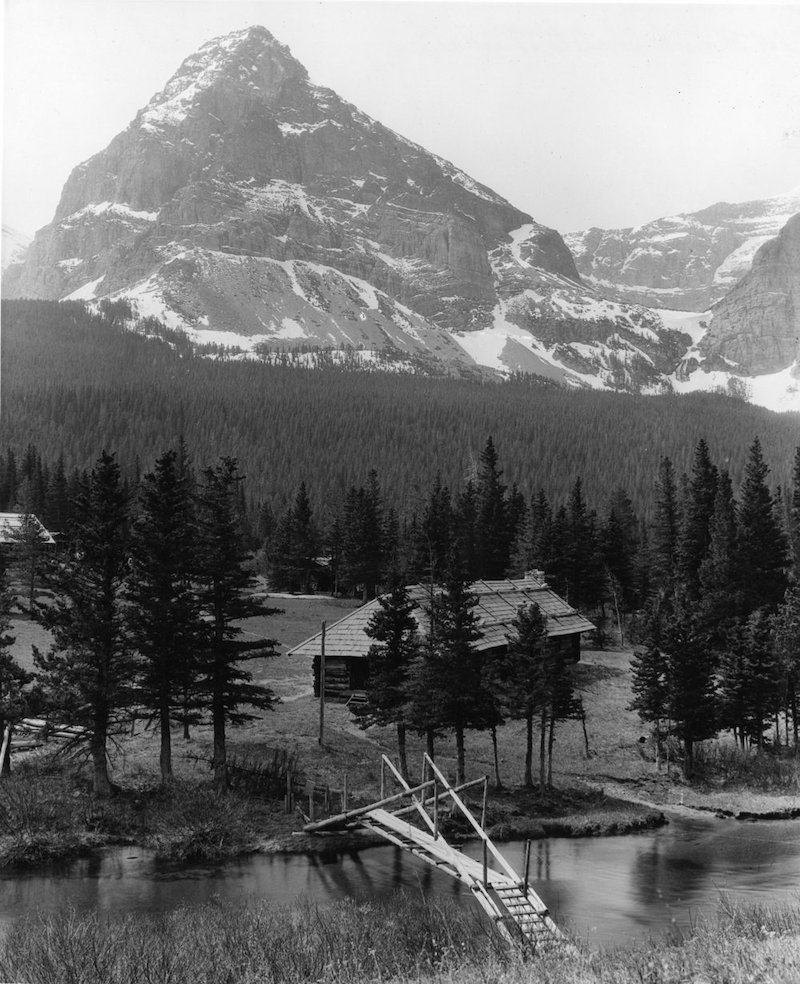
Step into the meadow, dappled with color early in the season, and begin your journey to Morning Star Lake. It’s hard to miss Bad Marriage Mountain on the far side of the North Fork of Cut Bank Creek. This beauty was the backdrop for a teepee camp and four chalets built by Great Northern Railway 1911-1913. The creek had long been a popular destination for anglers looking for a great fishing experience even before the park and Great Northern wanted to capitalize on that. All the construction is long gone, but Bad Marriage still welcomes visitors as they enter this wild part of the park.1
The footpath parallels the stream as it moves in and out of stands of lodgepole pine and subalpine fir that smell of fresh cut lumber on warm days. Ripening thimble berries crowding the footpath is a bonus for hikers mid to late summer. The gentle murmur of the moving water and the whisper of the breeze through the pines complete the takeover of the senses while disengaging any stress that hung on up to this point. But just so you’re not misled, the gentle breeze can transform into a notorious east side wind. Instead of a whisper, it’s more like a freight train.
At 3.9 miles, the trail splits. Go left. The right fork leads to Atlantic Creek Campground. A short distance west of the campsites, the route divides again. The left fork follows Atlantic Creek to Medicine Grizzly Lake lying against the base of Razor Edge Mountain. Going the other way leads to Triple Divide Pass.
The trail bends to the south, keeping the North Fork of Cut Bank Creek company all the way to Morning Star Lake, 2.8 miles from the junction. The summits of Medicine Grizzly Peak, west of the trail and Bad Marriage and Eagle Plume Mountains to the east, are like sentinels guarding the entrance to this valley that is a hide for Morning Star.

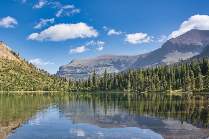
The grade steepens the last 0.6 miles before topping out. About one-fourth of the elevation gain for the trip is in this section. From the high point, there’s a gentle descent down to the beach of the charming 10-acre Morning Star Lake.
A backcountry campground sits at the head of the lake. Camping sites open around July 15 and two of the three are reservable.
A testament to the amount of snow this country gets was a football-field-size snow drift with a cavernous melt-water opening near the lake. The icy mass, a remnant of the previous winter or winters, still had not disappeared by September.
Hike Summary
| Total Distance: 13.4 miles |
| Total Elevation Gain: 920 feet; Loss: 297 feet |
| Difficulty: 15.2, strenuous (Calculated using Petzoldt’s Energy Rated Mile equation.) |
| Estimated Walking Time: 5 hours 50 minutes (Calculated using an average speed of 2.5 mph and Naismith’s correction for elevation gain.) |
Option
Make it a two-day excursion and see the outstanding country between Cut Bank and Two Medicine via Pitamakan Pass. You will need to decide which direction to hike.
Average elevation gain is 137 feet per mile, over 6.7 miles from the trailhead at Cut Bank to the Morning Star Lake campground. However, it’s three miles from Morning Star to Pitamakin Pass where you’ll average 623 feet per mile. Starting at Two Medicine, the climb averages 330 feet per mile over 7.5 miles to the pass and then another three miles down to the Morning Star Lake campground.
Either way, you’ll need two vehicles. On the Two Medicine side, there is a parking lot next to the auto campground that’s near the trailhead to Pitamakan Pass.
Glacier National Park Guidebooks
Experience the magic of the Going-to-the-Sun Road with this expertly crafted guide. Discover recreation opportunities, enjoy breathtaking views, and create a personalized itinerary that suits your travel style. Discover Glacier at your own pace. Order now and embark on an unforgettable journey through Glacier National Park.
Ready to explore? Tom Berquist, a local with nearly 1,000 miles of hiking the trails of Glacier under his belt, provides practical insights, detailed maps, wonderful photos, and valuable planning information. This guide is your trusted companion for an unforgettable East Side adventure.
Notes
- “Cut Bank Chalets.” National Park Lodge Architecture Society. Last modified , 2010. https://www.nplas.org/cutbank.html.
