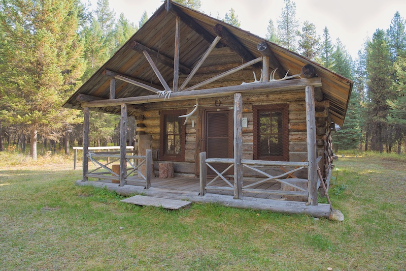
Trailhead
This hike is in the extreme northwest corner of Glacier National Park. To access it, drive to Polebridge, Montana, cross the bridge over the North Fork of the Flathead River, and arrive at the Polebridge Entrance Station. From May 24 to September 8, 2024, vehicle registrations were required to gain entry. These need to be purchased online before traveling all the way to Polebridge. Check here for more information.
From the entrance, drive a short distance to the T-intersection and turn left. The drive north from here is beautiful and follows the route of the wagon trail the Butte Oil Company built in 1901. Oil seeps around Kintla Lake got the attention of entrepreneurs seeking to capitalize on the discovery. They subsequently built the primitive road to haul oil drilling equipment to Kintla. But like mining on the east side of the park, it never panned out.
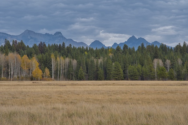
After about a half-mile, the Bowman Lake road enters on the right. Continue straight ahead and enter Big Prairie at about two miles. You’ll notice log cabins along this section. They are homesteads that were established before the surrounding land became a national park in 1910. Please note the buildings and surrounding land are private property. President William Howard Taft’s signature on the bill establishing Glacier National Park ensured the preservation of inholdings for homesteaders. You’ll find an interesting plaque at the McCarthy homestead, at 3 miles. Along the way I had to pause and take in the fantastic views east across the meadows with the ice sculpted peaks rising behind them.
At 12.2 miles, the road crosses Kintla Creek, climbs a bit and passes the trailhead at 12.5 miles. If you see horse hitching rails and a rundown ramp for unloading livestock, then you’re in the right place. The trail is an abandoned portion of the Inside North Fork Road extension that went to the Kishenehn Patrol Cabin and the Canadian border. The completion of this road in 1931 was a step towards establishing a continuous loop around the park.4
Hike Summary
| Total Distance: 9.6 miles |
| Total Elevation Gain: 335 feet; Loss: 430 feet |
| Difficulty: 10.3, strenuous (based on Petzoldt’s energy-rated miles) |
| Walking Time: 4 hours (using 2.5 miles per hour average & Naismith’s Rule) |
The Hike
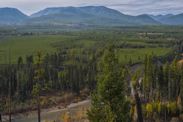
Right away, the route guides you through a section of “dog hair” lodgepole pine, which is the regeneration that came after the 2003 Wedge Canyon Fire. The path continues along the top of a steep drop-off, which allows for fantastic views of the North Fork of the Flathead River Valley. The story hidden in the rocks of this area is extraordinary.
Ancient Secrets
Glacier National Park’s mountains and bedrock are ancient – 1.6 billion years old. The only fossils found in this rock are stromatolites, which are the structures made by primitive blue-green algae. The geology under the North Fork Valley or Kishenehn Basin is another story. Forty-six million years ago, the 100-mile long Lake Kishenehn occupied this area and collected the eroded material from the higher ground surrounding its shores.3,5 Algal mats growing in the shallows trapped tiny insects and then entombed them as the algae died and sank to the bottom.3 In the rock of the Kishenehn Formation, researchers have discovered fossils of these insects, along with mollusks, fish and larger mammals like the uintathere.5
Then came the Pleistocene Ice Age that carved the magnificent landscape of the park. When it melted, the eroded material buried the Kishenehn Formation. But the beautiful river you’re looking out across has cut down through the glacial till and exposed some of its secrets. For example, scientists recovered fossilized snails from the Kishenehn and determined that they lived in wet-tropical or semi-tropical climates. The mind-blowing findings revealed from the lab are that some snails lived at elevations of 12 – 15,000 feet.5 The tallest peak in the park today is Mount Cleveland at 10,400 feet. Researchers also recovered a fossil tooth from an uintathere, a huge rhino like mammal.5 Remember the movie Jurassic Park, where a blood engorged mosquito fossil provided the DNA to clone dinosaurs? At the time of the movie, there had never been a blood-engorged mosquito fossil found anywhere. Dale Greenwalt discovered the first one on the planet around 2013 in the Kishenehn.3
Stream Ford #1
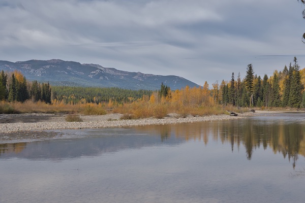
After a mile, the trail turns away from the river and then returns just after crossing Starvation Creek at 2.3 miles. In fall, the water level is pretty low. Spring runoff not so much. Where the trail intersects the creek, look downstream a short distance to see the remains of a bridge abutment.
The footpath hugs the river from 2.6 to 2.9 miles and then turns away into a dark spruce forest. In this section, watch on your left for an old abandoned log tower, which was likely part of a cable system for hauling people and material across the river.
Deadly Trap
Walking through the spruce, I kept trying to imagine where, along Kishenehn Creek, Slim Link (aka Arthur Meyer) met his demise. During the early 1900s, he trapped in the Kishenehn drainage and worked out of an 8 x 10 shack with a canvas door. Its location was upstream from the point where Kishenehn Creek flowed into the North Fork. In May of 1912, at the end of the trapping season, the pile of skinned carcasses near his cabin began to stink. Bears were attracted. He built a v-shaped bear pen and rigged up his .41 caliber Colt Thunderer so that a string attached to a treadle would pull the trigger when a bear stepped on it. Ripe beaver carcasses served as bait. Slim told friends when he would return to the homestead area around Big Prairie. His dog showed up. Slim did not. Friends found Slim’s blood-stained clothes in the cabin and located his remains scattered in the surrounding area. Based on the evidence, they concluded that he had gone outside to inspect his bear enclosure and, for whatever reason, triggered the mechanism, resulting in a gunshot wound just below the waist. He died in his bed. But the stench attracted a bear who dragged him out and had a meal.2
Stream Ford #2
The Kishenehn Creek ford is 4 miles from the trailhead. A rock cairn is on the bank to the left of the path. I recommend scouting to locate the optimal crossing point for the time of year you visit. This is bigger water than Starvation Creek and you could have up to three channels to navigate. Hiking poles are a definite advantage as you maneuver over slippery cobles with the current pushing against you. At a compass azimuth of 310 degrees from the rock cairn, a second hard-to-see cairn exists on the far side. Once you’ve crossed, find that pile of rocks then look for a small orange tag on a tree. The trail is there.
After the ford, the footpath borders what looks to be an extensive beaver pond. I located one lodge, but it didn’t appear to have any recent work done to it. At the 4.7-mile mark, you’ll encounter a trail junction. Take the left fork. Going right will lead you up and over Starvation Ridge to the Boulder Pass Trail along Kintla Lake.
The Kishenehn Corridor
The Kishenehn Creek headwaters are in Canada and the drainage forms a nice corridor for animals to move back and forth between Glacier and British Columbia. A female wolf was moving with two to three others, up to 30 miles on either side of the border.6 In April 1979, just north of the park, biologists captured a female wolf, put a radio collar on her and gave her the name Kishinena after the drainage she was in.1 In 1986, one of Kishinena’s offspring named Phyllis set-up a den just north of Polebridge inside the park.7 The wolves were back in Glacier National Park after a 40 to 50 year absence.

Furry animals were not the only creatures to use the Kishenehn Creek corridor. An ancient Kootenai Indian trail parallels the stream. They used the route to travel back and forth between what would become northwest Montana, into present day British Columbia and on to Alberta via Akamina Pass.8
Kishenehn Ranger Station
A tenth of a mile after the junction is the five building complex of the Kishenehn Ranger Station Historic District. The location is about 4.5 miles south of the Canadian border. The structures, including a ranger cabin, barn, woodshed, fire cache, and pit toilet, are still in excellent condition despite being built in the 1920s and 1930s. It’s obvious that not only the buildings but the surrounding grounds are being well-cared-for.


Glacier National Park Guidebooks
Invest in Your Next Adventure: For a small price, you can unlock countless hours of outdoor enjoyment. Start exploring!
Notes
- “Being (Re)colonized.” May 23, 2023, Season 3, Episode 10 in Headwaters podcast. Produced by Glacier National Park’s media team. https://www.nps.gov/glac/learn/photosmultimedia/headwaters-podcast.htm
- Fraley, John. Rangers, Trappers, and Trailblazers. Helena: Farcountry Press, 2018.
- Greenwalt, Dale, and Conrad Labandeira. “The Amazing Fossil Insects of the Eocene Kishenehn Formation in Northwestern, Montana.” Rocks and Minerals, vol. 88, no. 5, 13 Aug. 2013, pp. 434-41, https://repository.si.edu/bitstream/handle/10088/22578/paleo_Greenwalt__and__Labandeira_Rocks__and__Minerals_2013.pdf?sequence=1&isAllowed=y
- “Kishenehn Ranger Station Historic District.” National Archives Catalog. September , 1995. https://catalog.archives.gov/id/71974904.
- “North Fork.” 2021, Season One, Episode 3, in Headwaters podcast. https://www.nps.gov/podcasts/headwaters.htm?season=1#episodes
- Peterson, Chris. Hungry Horse News, July 10, 2019. https://hungryhorsenews.com/news/2019/jul/10/95774154/.
- Scott, Tristan. “40 Years of Wolf Recovery.” Flathead Beacon, April 23, 2021. https://flatheadbeacon.com/2021/04/23/40-years-of-wolf-recovery/.
- Thompson, Sally. People Before the Park. Helena, MT: Montana Historical Society Press, 2015.

2 responses to “The Kishenehn”
Great narrative., Tom. I haven’t been there in years. Your descriptive journey brought back many memories—-some that cant be repeated here.
LikeLike
Thank you, Anonymous. Glad you liked the post.
LikeLike