Finding the Trailhead
The trail to the Belly River Ranger Station is in the extreme northeast region of Glacier National Park. From the intersection of the Many Glacier Road (Glacier Route 3) and U.S. Highway 89, drive 4.3 miles north on U.S. Highway 89. Turn left on Montana Highway 17 (Chief Mountain Highway). After driving the scenic 14 miles on Highway 17, look for a large parking lot on your left. You’ll be able to see the border crossing into Canada a short distance down the road. Walk along the west side of the parking lot heading north. The trail veers to your left just after the garbage dumpster. If you make it to the restrooms, you’ve gone too far.
The following description is for an out-and-back day hike. But you could plan to camp at the Gable Creek Campground near the Belly River Ranger Station and do day hikes from there to explore the area. More about that in the Options below.
Hike Summary
| Total Distance: 12.4 miles |
| Total Elevation Gain: 380 feet; Loss: 1,009 feet |
| Difficulty: 13.2, strenuous (based on Petzoldt’s energy-rated miles) |
| Estimated Walking Time: 5 hours (using 2.5 miles per hour average & Naismith’s Rule) |
The Hike
Notice that the Difficulty score for this hike is 13.2. I calculated that using the standard method of measuring the elevation gain from the trailhead to the farthest point. But, this route is a little different. You’ll lose a lot of elevation in the first couple of miles. Of course, when you’re headed back to the parking lot, you’ll need to climb back up. Total loss in elevation to the ranger station is 1,009 feet. Recalculating Difficulty using that loss as a gain results in a Difficulty of 14.4. It may seem like more with tired legs.
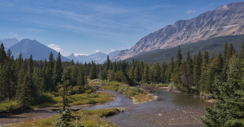
The steepest part of the descent to the valley floor starts at three-quarters of a mile from the trailhead and continues through a series of switchbacks to 1.4 miles. At 2.5 miles, you’ll see the first of several meadows, some pretty large. During my last trip, I observed browsed shrubs near the edges of the meadows, which gave me hope of seeing the browsers. I scanned the meadows as I went along, but struck out.
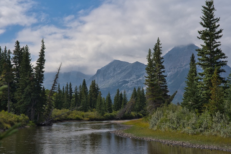
A sweet view of the Belly River awaits at 3.1 miles. This and the Saint Mary River are in the Hudson Bay watershed. A 1670 royal charter from King Charles II of England granted the Hudson’s Bay Company a monopoly of commerce on all land within the Hudson Bay drainage basin. Since the infamous ranger/poacher Joe Cosley seemed to do okay acquiring pelts in this region, it’s probable that trappers and traders from the Hudson’s Bay Company may have come here looking for fur too.
As you enter the larger meadows, Cosley Ridge, straight ahead, becomes more prominent. To the right of the ridge is the valley where the Mokowanis River tumbles from its birth atop the Continental Divide at Sue Lake. The Belly River flows to the left side of the ridge from its headwaters in Helen Lake, which lies at the base of the Ptarmigan Wall. The Mokowanis joins the Belly about a half mile southwest of the Belly River Ranger Station.

You’ll know that the ranger station is near when you see a pole fence across the trail. Before the fence, at six miles, is a path to the right. This leads to the Gable Creek backcountry campground. Another 200 feet and also before the fence, the Cosley Lake Cutoff Trail leaves to the right.
Continue through the fence stile and you’ll see another pole fence. As you proceed toward that fence, you’ll come to another trail junction. The Belly River Ranger Station Trail heads to the right towards Elizabeth Lake. To the left is the Gable Pass Trail, that passes to the west of the ranger station.
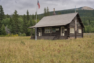
Belly River Ranger Station
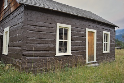
The Belly River Ranger Station built in 1925 remains the only station in the park not accessed by a road. The original Belly River Ranger Station, constructed in 1912, sits right behind the 1925 building. It’s surprisingly well-preserved. After 1925, rangers used the original station as a barn but now it’s used for storage.
Options from the Campground
- Out & Back: Cosley Lake Campground
Total 6.0 miles with 472 feet of elevation gain.
Proceed to the Cosley Lake Cutoff Trail mentioned above. The Gros Ventre Falls spur trail is at 1.7 miles. At 2.2 miles, take the right trail fork towards Stoney Indian Pass. The campground trail junction is .7 miles farther. The views from the campground are spectacular. - Loop: Dawn Mist Falls, Cosley Lake, Gros Ventre Falls
Total – 6.6 miles with 702 feet of elevation gain.
Starting at the Gable Creek Campground trail intersection with the Belly River Trail. Proceed to the Belly Ranger Station Trail toward Elizabeth Lake. Just after crossing the Belly River at 1.6 miles, turn left onto the Ptarmigan Trail. The junction for the falls is at 2.1 miles and then a tenth of a mile to the falls.
Reset your distance and backtrack north 2.2 miles on the Ptarmigan Trail to the ford of the Mokowanis River at the outlet of Cosley Lake. After the ford, at 2.3 miles, the Ptarmigan Trail intersects the Stoney Indian Pass Trail coming from the left and the Cosley Lake Cutoff Trail from the right. Turn right. You’ll find the short path to Gros Ventre Falls at 2.7 miles. The Gable Creek Campground path is 4.4 miles. - Out & Back: Elizabeth Lake
Total 7.2 miles with 464 feet of elevation gain.
Proceed from the campground to the Belly River Ranger Station Trail and continue to the Belly River crossing and the Ptarmigan Trail at 1.6 miles. Turn left on the Ptarmigan Trail toward Elizabeth Lake. The Dawn Mist Falls junction is at 2.1 miles. You’ll reach Elizabeth Lake at 3.6 miles.
Glacier National Park Guidebooks
Your Ultimate Guide to Going-to-the-Sun Road: Invest in your adventure and unlock the full potential of this iconic road. For the price of a movie, a lifetime of memories.
A Hiker’s Companion: For a small price, you can unlock countless hours of adventure. Start exploring!
