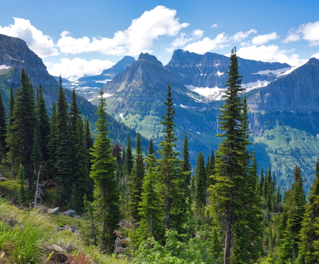
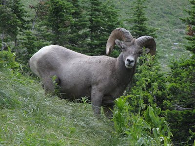
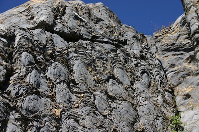
This is a hike that you will not soon forget. It has it all. Glacially carved peaks and valleys, meadows loaded with wildflowers, bighorn sheep, mountain goats, occasional grizzly bears, hoary marmots, coyotes, and the tiny chance early or late in the season of wolverines. And, some of the oldest fossils preserved in any national park can be seen along the way.6 The commonly used superlatives seem to fall short when experiencing this route.


And, of course, the word is out. The Highline Trail is one of the most popular in the park. University of Montana researchers tell us that 500 to 1,000 people use this trail each summer day.3
Transportation Planning
There are transportation logistics to consider for this walk from Logan Pass to the Loop. One possibility is to leave your vehicle at the Loop (where you will exit) and catch a ride to the pass on a Glacier National Park shuttle. In the past, shuttles left the Apgar Visitor Center at 7am for the day’s first run.
If you want to get on the trail earlier, drive to Logan Pass and grab a parking spot. In July, the sun rises between 5:30 and 6:00 am, and I’ve seen the lot about two-thirds full by then. The downside of relying on the shuttles at day’s end when you’re tired is the potential for a long wait time to get a seat.
Opportunities for driving or using the shuttle system along the Going-to-the-Sun Road has been in a state of flux. I suggest visiting Glacier National Park Vehicle Reservation System and Glacier’s Shuttle System webpages for up-to-date information on schedules and ticketing.
Trailhead
At the end of the post, I’ll offer some variations of the Logan Pass to the Loop walk.
You begin at an elevation of 6,646 feet from Logan Pass. The trail starts on the far side of the Going-to-the-Sun Road from the visitor center parking lot. Once on the footpath, stop and take a deep breath. The fresh mountain air with the sweet, resinous scent of the stunted subalpine fir trees and the pleasing woodsy smells are the signals that it’s time to slow down and leave the world behind.
The Hike
Imagine several canvas wall tents to your left as you walk across the relatively level area at the start. From 1925 to 1928, workers blasted a shelf into the cliffs, which became the upper part of the Going-to-the-Sun Road from Logan Creek to the pass. Those tents housed the hardy souls of Camp #6. It took a day for packers and their strings of horses following the long-forgotten trail up the Logan Creek to bring supplies to the camp.5
A quarter-mile from the trailhead, you’ll get to experience a little of what the powder monkeys and route surveyors encountered in the 1920s. The path narrows somewhat and becomes a ledge in the rock face 100+ feet above the Going-to-the-Sun Road. It’s safe, and there’s a cable bolted into the rock for hanging on to should you desire. This is not a great place to run into a grizzly bear, as one hiker experienced.
The path gradually climbs along the Garden Wall for three miles and then steepens as it rises to the saddle between Haystack Butte and Mount Gould. This is a popular spot for folks to stop for a rest and grab a bite to eat. Some decide this is their turnaround location, which would give them a seven-mile day.

Remember Camp #6 back at the beginning? Well, construction crews built Camp #4 in the ravine on the north side of Haystack Butte. It’s incredible the amount of stamina and strength required of the workers. Their day included descending the steep mountainside to the construction site, putting in a full day of extreme physical and exhausting work, and then climbing back up to their tents.5
After leaving the saddle, the footpath continues to climb, reaching its highest point at four miles and 7,300 feet. There is a gradual decline to the Grinnell Glacier Overlook Trail at 6.8 miles. The overlook path leads to the top of the Continental Divide (Garden Wall) with views of Salamander and Grinnell Glaciers, Upper Grinnell Lake, Mount Gould, and Angel Wing. This side trip is 0.8 miles long, with over 900 feet of elevation gain. To do that on top of an already long day requires better than average physical condition.

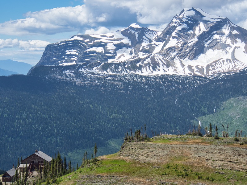
From the overlook trail junction, it’s a fairly level 0.7 miles to Granite Park Chalet. Great Northern Railway contracted to have this Swiss-style structure built of locally quarried stone in 1914. It’s now a National Historic Landmark.4 During the early 1900s, the Glacier Park Saddle Company treated visitors to over 50 miles of pristine Glacier backcountry on the famous North Circle trip. Granite Park Chalet was their first stop.5
The chalet generally opens the end of June and closes for the season the first part of September. If you’re running short on water, it is available for purchase or there’s a water source not far from the chalet. Be sure to purify it.
The last 4.2 miles of this trip drops 2,200 feet in elevation. If you have knee problems, you may want to reconsider this section. I know this firsthand. The footpath travels through the forest for just over a mile. Then the trail enters the area burned by the 18,702-acre Trapper Creek Fire of 2003. During that summer, dubbed the Summer of Fire, 135,000 acres of Glacier National Park burned (approximately 13% of the park’s total area). The Northern Rockies lost nearly three-quarters of a million acres that season.7
Hike Summary
| Total Distance: 11.4 miles |
| Total Elevation Gain: 1,630 feet; Loss: 4,014 feet |
| Difficulty*: 14.7 (strenuous) (Calculated using Petzoldt’s Energy Rated Mile equation.) |
| Estimated Walking Time: 5 hours 23 minutes (Calculated using an average speed of 2.5 mph and Naismith’s correction for elevation gain.) |
Alternatives
If the trip described above is not for you, the following may be of interest.
- After resting at the chalet, return to Logan Pass the way you came. The total distance for this is 15 miles.
- Continue on past Granite Park Chalet to Swiftcurrent Pass, then continue on the Swiftcurrent Pass Trail to the Swiftcurrent Motor Inn in Many Glacier. The total distance is 15.2 miles – about the same as the out and back from Logan Pass. At Many Glacier, catch the Glacier National Park Lodges fee-based hiker’s shuttle to Saint Mary. From Saint Mary, use a Glacier National Park shuttle to return to Logan Pass. For more details, see my post for the hike from the Swiftcurrent Motor Inn to Swiftcurrent Pass .
Safety Considerations
No one expects to sprain an ankle, or worse. Snow in July? C’mon. Well, in Glacier National Park, it happens. So do unexpected drops in temperature with high winds and rain. Starting a hike late in the day while underestimating the time required to finish is not all that rare of an occurrence. And then there is always the chance of an unexpected encounter with wildlife that goes badly. Most don’t expect to spend the night out in the wilderness when on a day hike. However, it is something that one should plan for.
If you’re relatively new to backcountry travel, I think the following might be helpful.
Ten Essentials
These should always be in a hikers pack and adjusted for the current season and hike difficulty.
- Hydration: Consume at least 0.5 liters per hour, more on hot days or more strenuous hikes. Pack an effective water filter and locate potential water sources on your map before starting longer treks.
- Nutrition: Bring more nutritious calories than you calculate needing. Dried fruit, fresh fruit, peanut butter and jelly sandwich, nuts, jerky, granola, etc., are good choices. Check out this calculator to dial in the calories you’ll need based on weight, walking speed, and slope
- Navigation: primary – map and compass, secondary – GPS with extra batteries; knowledge of how to use these tools is critical; knowing your walking speed in different conditions is valuable for estimating time to a landmark identified on your map (e.g., It looks like the trail junction is about one mile away. It’s getting dark, but I usually average about 3 miles per hour on this sort of trail. So, I should see the junction in about 20 minutes.) The goal is to stay found.
- Emergency Shelter: jumbo plastic garbage bag, bivvy sack, ultralight tarp
- Clothing: Layers – base, mid, insulating, and shell. Add and remove layers to manage body heat. Never wear cotton. Choose fast-drying synthetics or wool. Wear sturdy footwear. Your feet will thank you. Include light-weight gloves and a beanie.
- Headlamp and extra batteries.
- Firestarter: lighter, waterproof matches, cotton balls saturated with vaseline.
- First Aid: Remember, the kit is next to worthless without knowing how to use the items contained within.
- Repair kit: minimum of knife or multi-tool, duct tape, paracord
- Sun protection: for skin, eyes, and head
Top Safety Concerns in Glacier National Park
Glacier National Park Guidebooks
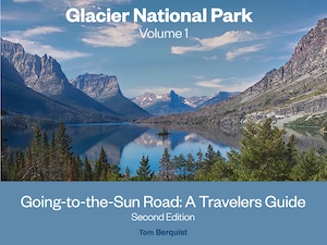
Don’t just visit Glacier, experience it! This guide provides all the essential information you need for a seamless and enjoyable trip across the world-class Going-to-the-Sun Road. From lodging and dining to hiking trails, scenic viewpoints, and more, this guide has you covered. Order now and start planning your adventure.
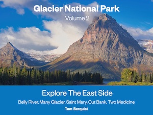
A Local’s Hiking and Planning Guide for Eastern Glacier: Don’t let the park’s vastness overwhelm you. Our comprehensive ebook is your key to unlocking over 50 hikes through Glacier goodness. A one-time purchase, a lifetime of memories.
Notes
- Born, Steve. “The Top 10 – The Biggest Mistakes Endurance Athletes Make.” Hamer Nutrition. https://www.hammernutrition.com/knowledge/essential-knowledge/10-biggest-mistakes-endurance-athletes-make.
- “Dehydration.” Cleveland Clinic. 2019. https://my.clevelandclinic.org/health/treatments/9013-dehydration.
- “Examining Visitor Use Trends In Glacier National Park.” Glacier National Park Conservancy. Last modified April 14, 2021. https://glacier.org/newsblog/examining-visitor-use-trends-in-glacier-national-park/.
- “Granite Park Chalet & Dormitory.” National Register of Historic Places. Last modified November 18, 1982. https://tinyurl.com/yc8w7x36.
- Guthrie, C.W. Going-to-the-Sun Road: Glacier National Park’s highway to the sky. Helena, MT: Farcountry Press, 2006.
- Hunt-Foster, Rebecca K. “The Stromatolites of Glacier National Park.” National Park Service. Last modified , 2018. https://www.nps.gov/articles/park-paleo-fall-2018-stromatolites.htm.
- “The Fires of 2003: an anthology.” The Inside Trail, Glacier Park Foundation. Last modified , 2004. http://www.glacierparkfoundation.org/InsideTrail/IT_2004Win.pdf.
