On the east side of the Continental Divide, within the Lewis Mountain Range of Glacier National Park, lies the spectacular hike to Siyeh Pass. At 7,750 feet (2,362 meters), the pass is on one of the highest maintained paths in the park. It’s not unusual for snow to linger into late July or early August.
Trailhead
The hike described below begins at Siyeh Bend which is 2.8 miles (4.5 kilometers) east of Logan Pass and 15.2 miles (24.5 kilometers) west of Saint Mary, Montana. One can also enter the hike at the Jackson Glacier Overlook or Sunrift Gorge. However, beginning at those locations, the mileage or elevation gains will make your walk a little more difficult.
The hike is a point-to-point trip. So, getting back to your vehicle requires a little planning. One can park their car at Siyeh Bend and then at the end of the hike catch the westbound Glacier National Park free shuttle from Sunrift Gorge back. Consider if waiting up to an hour for your ride after a day of hiking is okay. Some folks prefer their vehicle waiting (with cold beverages and snacks) at the exit point. If that’s the case, park at Sunrift Gorge and catch the shuttle to Siyeh Bend. Glacier maintains a helpful “Shuttle Stops” webpage for planning.
Bring plenty of water and fuel for your body since you’ll be out at least five to six hours. You’ll cross the headwaters of Siyeh Creek while walking through Preston Park on the way to the switchbacks. This is a great place to filter water.
The beautiful meadows of Preston Park are also grizzly bear haunts. Bear spray is a necessity. Keep the canister where it is readily available and be sure to know how and when to use it. When coming to a blind curve or dense growth of trees and shrubs, let the bear know where you are by making a noise loud enough to be heard over the infamous strong winds that frequent the area. A surprised bear is not in anyone’s best interest.
Siyeh Bend Cut-Off Trail
At the trailhead, facing upstream, Piegan Mountain rises to your left. On your right is Going-to-the-Sun Mountain followed by Matahpi Peak to the north. If you face downstream, there are two glaciers in the distance. Once one mass of flowing ice but now two, Jackson Glacier sits to the right and Blackfoot Glacier on the left.
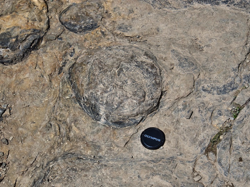
The Siyeh Cut-Off Trail strikes out alongside Siyeh Creek. Soon after getting underway, look for rounded knobs with diameters ranging from that of an orange to a volleyball rising out of the rock underfoot. These are the tops of mound-like stromatolites created by single-celled photosynthetic cyanobacteria over a billion years ago. The organisms lived in the shallows of the ancient Belt Sea much as they do today in Shark Bay, Australia. Stromatolites, 3.5 billion years on our planet, are the oldest evidence of life. It’s thought they played a significant role in increasing the concentration of oxygen in the Earth’s atmosphere.⁷
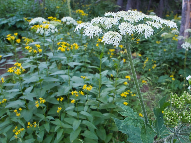
The Cut-Off Trail climbs 1.2 miles (1.9 kilometers) through a spruce and subalpine fir forest on its way to the Piegan Pass Trail. From July to August, the white umbrella-shaped flower clusters of cow parsnips are on display. When their hollow stems are still succulent, grizzly bears feast on them.
At the trail junction, turn left onto the Piegan Pass Trail. Going right will lead to the Jackson Glacier Overlook along the Going-to-the-Sun Road. As you move north, views of Piegan Glacier nestled in a northeast-facing cirque and Mount Siyeh to the north continue to improve. After 1.5 miles (2.4 kilometers), look for the Siyeh Pass Trail junction on your right.
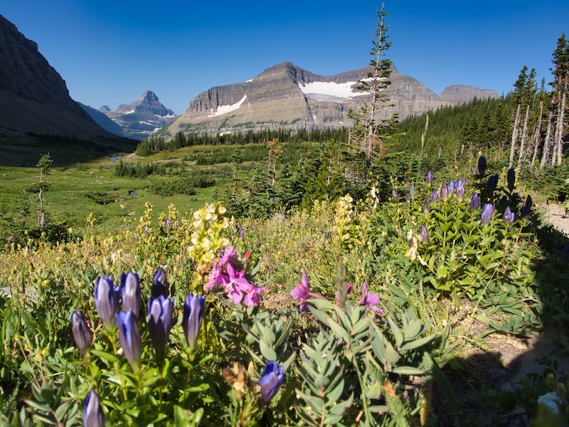
Preston Park and Siyeh Pass
From the junction, it is two miles (3.2 kilometers) to the pass. But before the significant elevation gain starts, the footpath leads through a small valley with meadows interspersed among stands of stunted subalpine fir. As soon as the snow is off, the floral displays begin and last through August. This is Preston Park.
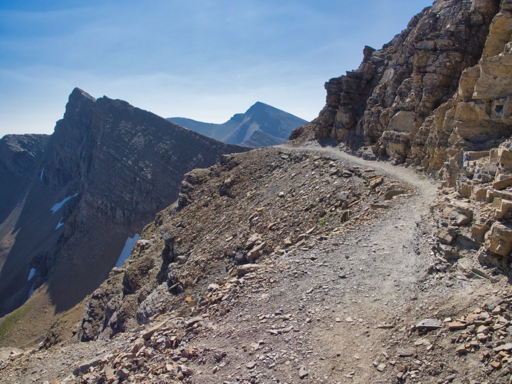
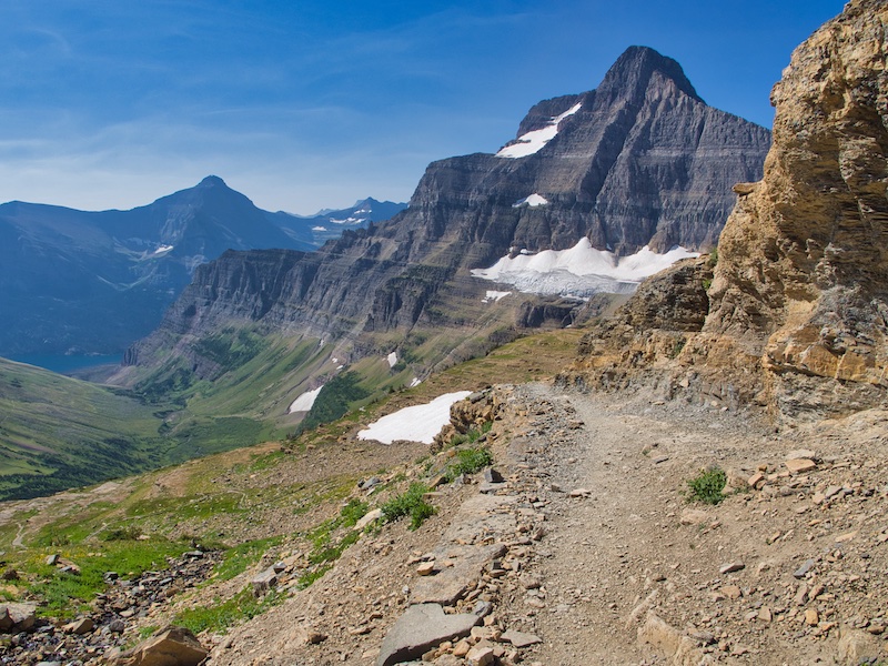
The final push to reach the 7,750-foot ( 2,362 meters) pass happens via several switchbacks. Mount Siyeh fills the view to the north. To the northeast, trail deficient Boulder Creek Valley appears as your altitude increases. A cone-shaped pile of rocks marks the pass.

During the late 1920s, Great Northern Railway (GNR) paid workers to place locomotive bells at Piegan, Siyeh, Swiftcurrent Passes, and Scenic Point. It was a promotional gimmick based on an old Swiss custom of climbers and hikers producing a clear musical note when they reached a pass or summit. In the fall of 1943, GNR removed the bells and donated them to the World War II scrap metal drive.⁶ The short bell tower base is intact at Piegan Pass. However, all that remains at Siyeh and Swiftcurrent Passes are piles of rocks. If there are remnants at Scenic Point, I’ve missed them.
Glaciers
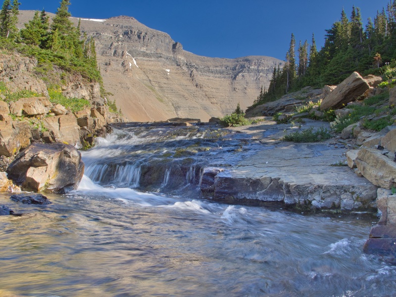
Look to the west after crossing the pass. Sexton Glacier lies in a crescent-shaped cirque linking Matahpi Peak and Going-to-the-Sun Mountain. Glacial meltwater becomes the slave of gravity, creating beautiful waterfalls crashing over 1,000 feet (305 meters) supplying the water which forms Baring Creek.
Scientists estimate that Sexton Glacier and the other 25 glaciers in the park are 7,000 years old.⁵ They are not remnants of the Pleistocene Epoch’s Great Ice Age that began around 2 million years ago. During the Pleistocene, flowing ice filled the valleys of Glacier and carved the spectacular landscape features we enjoy. It ended 12,000 years ago.⁴
Glacier National Park’s glaciers peaked during the Little Ice Age in the mid-1800s. Then, 146 glaciers existed. A massive 2,000 acre (809 hectares) body of moving ice occupied the enormous cirque between Mount Logan and Mount Jackson. Today, after losing over 70% of its ice, two smaller glaciers remain, Blackfoot and Jackson.¹
Sexton Glacier covered an area 43% larger in the 1800s than it does today. Piegan Glacier is 21% smaller.¹
There’s not enough snowpack to counteract the upward trend in temperature. Even with natural weather fluctuations, the Earth has warmed about 1.5 °F over the last 100 years. Northwest Montana has warmed about twice that rate.² This rate of increase is higher than any in the previous 800,000 years.³
Baring Creek Drainage
A significant snowfield on the south side of the pass can persist well into summer. It’s steep. During the early part of past summers, Glacier National Park trail officials have recommended an ice ax, crampons, and the skills to self-arrest.

In the first two miles beyond the pass, the trail drops over 1,000 feet (305 meters) in elevation through a series of switchbacks. After this descent eases up, keep an eye out for huckleberries along the trail. Late July until early August should be the best time to find this unique and delicious fruit. Eating huckleberries off the bush while taking in world-class vistas makes for memories which are hard to erase.
Little Chief, Mahtotopa, and Red Eagle Mountains on the far side of Saint Mary Lake become harder to ignore as their size appears to increase while the trail nears its end. About one mile from the trailhead and close to the footpath, Baring Creek tumbles over red rock of the Grinnell Formation. It’s well worth the time to sit by the stream and take this in for a while.

When I hear the traffic on the Going-to-the-Sun Road, I’m disappointed that the trip is over but very thankful that it happened at all.
Siyeh Pass Hike Summary
| Total Distance | 9.7 miles |
| Total Elevation Gain | 2,427 feet |
| Total Elevation Loss | 3,559 feet |
| Difficulty | 14.6, strenuous* (Score calculated using the Petzoldt equation for energy-rated miles.) |
| Total Walking Time | 5 hours 6 minutes (at 2.5 miles-per-hour and allowance for elevation gain) |
(For comparison: Saint Mary Falls, 2.9 easy; Piegan Pass, 12.5 strenuous.)
Notes
- “Area of the Named Glaciers of Glacier National Park and Flathead National Forest including Little Ice Age Extent, and Years 1966, 1998, 2005, 2015.” United States Geological Survey. Accessed August 8, 2019. https://www.usgs.gov/media/files/table-depicting-area-named-glaciers-gnp
- “Climate Change.” Glacier National Park, National Park Service. Last modified April , 2019. Accessed August 9, 2019. https://www.nps.gov/glac/learn/nature/climate-change.htm.
- “How is Today’s Warming Different from the Past?.” NASA Earth Observatory. Last modified June , 2010. Accessed August 9, 2019. https://earthobservatory.nasa.gov/features/GlobalWarming/page3.php.
- Raup, Omer B., Robert L. Earhart, James W. Whipple, and Paul E. Carrara. Geology Along Going-to-the-Sun Road Glacier National Park, Montana. West Glacier, MT: Glacier Natural History Association, 1983.
- “Retreat of Glaciers in Glacier National Park.” USGS: Northern Rocky Mountain Science Center. Accessed August 1, 2019. https://www.usgs.gov/centers/norock/science/retreat-glaciers-glacier-national-park?qt-science_center_objects=0#qt-science_center_objects.
- Robinson, Donald H. Through the Years: in Glacier National Park. 5th ed. West Glacier, MT: Glacier Natural History Association, Inc., 1973.
- “The History of Life on Earth.” Department of Astronomy, Indiana University. Accessed March 25, 2019. http://www.astro.indiana.edu/gsimonel/build/History_of_Life.pdf.
